Tuesday, June 30, 2015
Howe Sound Exploration
Temperatures this weekend (June 27/28) called for aquatic adventures, so we packed our ocean kayaking gear for some Howe Sound exploring. Paddled around the north tip of Anvil Island to the norths side of Howe Sound and on to Gambier where we found a great little camp spot (OK, we actually had some beta from one of Pete's UWH buddies, thanks!). Nice hanging out in the shade of a big cedar tree in the morning. Had a late morning start and paddled down the eastern coast of Gambier when we were surprised by a humpback surfacing just behind us. Came up 20 meters from Pete! The whale didn't mind us kayakers and kept traveling close to shore. On the way back from the southern most tip of Gambier we stopped at Pam Rocks to visit the seals on our down wind/flood tide paddle back to Porteau Cove. Afternoon strong winds were predicted by the marine forecast but never materialized.
We even got to test some of our safety equipment (our pumps) when we came across a half sunken canoe and 5 kids in the water. They wanted to swim it back to the dock which was a couple of km back but we convinced them it would be easier to get it to shore (50 meters away) and empty it.
I emailed the whale sighting to the Cetacean Sightings Network (@Vancouver Aquarium) and received the following reply: "While we are not sure exactly why these animals are visiting Howe Sound more often, it may have to do with recovering forage fish stocks in the area, as the Sound continues to recover from historic industrial activity." --- Nice!
Monday, June 15, 2015
Getting High in the Fraser Valley - June 14
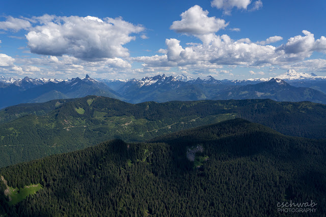
Light outflow winds in the Fraser Valley. Sometimes that means not the best flying conditions and bumpy air, sometimes its epic. Sunday was one of the epic days, getting a ways above Mt Cheam summit elevation (though for me not directly over the peak). Pretty amazing nevertheless, flying and looking down at the Cheam range.
 |
| Cheam Range: Mt Cheam, Lady Peak, Knight, and Welch. |
 |
| Looking south Mt Baker, McGuire (middle ground), Tomyhoi, Shuksan and the Border Peaks, Mt Slesse. |
 |
| East view Fraser Valley and Harrison Lake upper left. |
Wednesday, June 10, 2015
Seed Peak - June 6
We finally bagged Seed Peak last weekend on the third attempt. It has been on our list for a couple of years. Nice trail through majestic mountain hemlock old growth, along an alpine ridge with gorgeous views and up the still snowy bowl of Seed Peak. Photo shows us coming down from Seed Peak, Mt Gillespie in the middle and Judge Howay and Mt Baker on the horizon.
The only drawback were the many wash-outs on Mamquam FSR. Our trusty Tracker overcame several of the obstacles but in the end we had to hike more than an hour on the logging road to get to the trail head.
There was a major washout even on the main Mamquam FSR. Would have been another 1.6 km (one way) if the Tracker wouldn't have made it across, with more smaller washouts even before this. Maybe this was caused by the same rain event that caused the Seymour slide? We were in the area last fall and the roads were OK then.
 |
| Pete descending Seed Peak, Mt Gillespie in the middle, Robbie Reid left and Mt Baker on the right horizon |
Monday, June 1, 2015
Nicomen Island Circumnavigation - May 30
With strong inflow winds (=un-flyable for paragliders) in the Fraser Valley I thought it would be great to get in our kayaks again. And why not, after a hiatus of >8 months, start properly with a 7h/40km tour.
I’d been looking at the sloughs around Nicomen Island and was wondering if the waterways could be connected for a circumnavigation.
We put our kayaks in the water at the foot of Harrison Knoll. It took two short portages to get on the Fraser River. Water was high and we floated downriver with up to 15km/h speed (not really a beginner paddle with the quick current, water in the trees and few safe places to go to shore). The mighty Fraser with its spring runoff carried us quickly past Chilliwack and Sumas Mountain. There we turned into Nicomen Slough where the inflow winds helped with the ‘upstream’ leg which wasn’t really upstream since the slough is dammed at its top end and Norrish Creek didn’t add much current (we paddled up Norrish to some nice bathing spots).
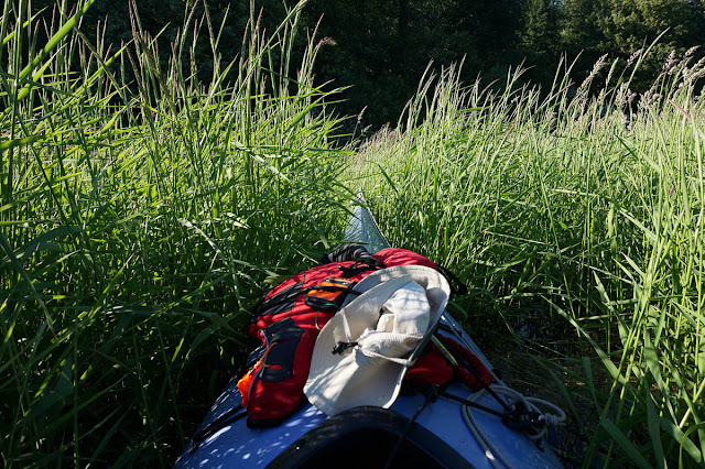
Everything worked according to plan until we encountered some prime kayak bushwhacking east of the Deroche Bridge. Always something new like portaging a sea kayak over fallen trees and beaver dams and pulling ourselves forward through tall grass. In the end we went up the wrong creek in one of the tall grass meadows and took out 700 meters from where we launched.
Fraser at Mission 8400-8500 m3/s = 4.4 m (on our Hope to Home paddle August 2014 about 1000 m3/s).
Subscribe to:
Posts (Atom)


